


Information about the activities of firefighting aircraft and helicopters is often scattered across flight-tracking services, NOTAMs, temporary restricted airspace zones and various national sources. To bring all of this information together in one place, Matej Bučarić developed an automated system that uses Discord to track firefighting operations in Croatia and six other European countries.
The project was created in response to the need for clearer and more up-to-date information about which aircraft are involved in firefighting operations, where they are currently located and how long they have been flying.
“The project arose from a simple need: information about firefighting activities is scattered across many different sources, making it difficult to see in one place what is currently happening,” Bučarić explained to AvioRadar.
According to him, official and media reports often fail to provide a sufficiently detailed overview of the current activities of firefighting fleets.
“Domestic media outlets are often not up to date with information on how many aircraft are fighting a fire in a particular area. That is probably not an issue for most people, but those who regularly follow such operations find that this information is missing,” says the project’s creator.
His goal was to present publicly available data in a way that would be useful to the wider community, rather than only to people professionally involved in aviation.
“I wanted to bring the data together in one place and present it in a way that would be understandable both to spotters and to anyone interested in how firefighting fleets operate during the season,” Bučarić adds.
The idea for the project first emerged approximately four years ago, when the first part of the application was developed to automatically identify new NOTAM activations. The project did not take off at the time, but Bučarić returned to it several weeks ago and expanded it into a considerably more comprehensive system.
“The idea is not actually new. About four years ago, I created part of an application that identifies new NOTAM activations, but the project did not take off at the time. Several weeks ago, I returned to it and expanded it into what it does today,” he said.
The application continuously monitors two publicly available data sources. The positions of aircraft transmitting data through their transponders are obtained from Flightradar24, while information about NOTAMs and temporary flight restrictions is sourced from the AMC portal of Croatia Control. This also includes temporary restricted airspace zones established around areas affected by wildfires.
“The application continuously monitors two public data sources. The first is Flightradar24, which provides the positions of aircraft transmitted through their transponders. The second is the AMC portal of Croatia Control, which provides NOTAMs and temporary flight restrictions, including zones introduced around wildfires,” Bučarić explains.
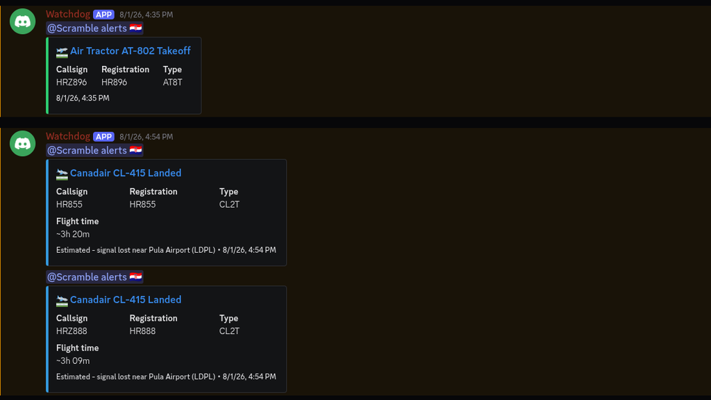
Behind the system is a database of firefighting aircraft and helicopters containing information on their registration, type, operator, year of manufacture and usual area of operation. When an aircraft in the database takes off, the system automatically identifies it, publishes a notification and tracks it until landing, after which it records the duration of the flight.
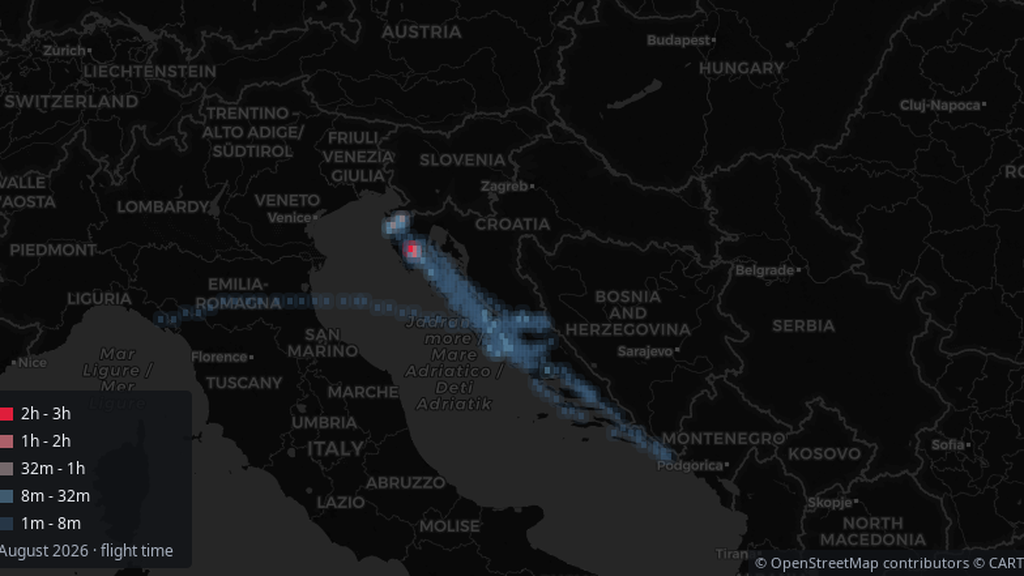
“When an aircraft from the database takes off, the system identifies it, publishes a notification and tracks it until it lands, at which point it records the duration of the flight. These records are then used to automatically generate daily, monthly and annual statistics, as well as maps showing where operations actually took place,” the project’s creator explains.
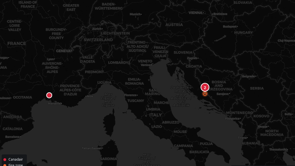
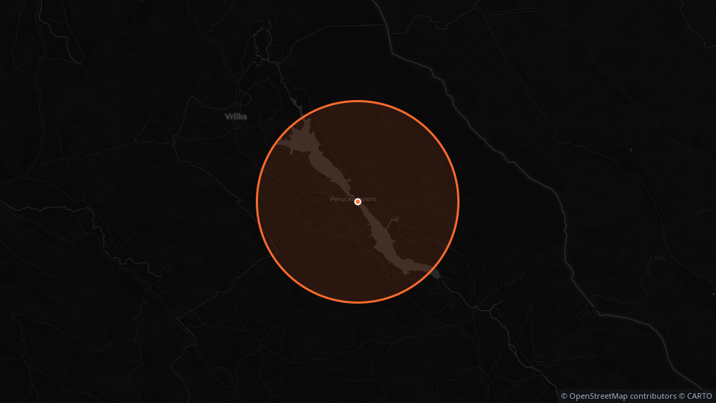
Users receive notifications for every take-off and landing, together with the aircraft type and flight duration. The system also displays active firefighting NOTAMs and temporary flight restrictions, along with maps of the areas to which they apply.
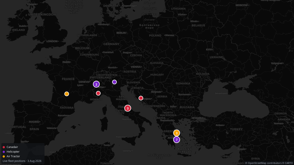
Each country has its own dedicated channel, allowing users to follow only the area that interests them. A combined overview of all currently active firefighting flights across Europe is also available, including a map and the aircrafts’ current positions.
The maps automatically adapt to the actual situation. Under normal circumstances, the display for Croatia covers Croatia and the surrounding countries. However, if a Croatian Canadair is deployed abroad, the map expands to include its location.
“The display for Croatia usually covers Croatia and the surrounding area, but if one of our Canadairs is deployed abroad, for example in France, the map automatically expands to include it. There is also a combined display for the whole of Europe, which shows at a glance all the locations where firefighting operations are taking place at that moment,” Bučarić says.
The collected records are used to automatically generate daily, monthly and annual statistics on the number of flights and total flight time for each aircraft. The data is also grouped by aircraft type, while monthly heatmaps show the areas in which firefighting fleets have operated most frequently.
The entire system operates automatically, 24 hours a day, on a server. The data is not entered manually but is continuously updated, while the aircraft database is expanded on a daily basis.
“Everything is automated and runs 24 hours a day on a server. The data is not collected manually but is continuously updated, while the aircraft database is expanded day by day, partly with the help of the community, which reports missing aircraft,” the project’s creator points out.
The project currently covers Croatia, France, Spain, Greece, Italy, Turkey and Portugal, along with several aircraft from Cyprus, Morocco and neighbouring countries.
Croatia’s firefighting fleet is covered in full, with all 12 aircraft included. In France, 30 of an estimated approximately 40 aircraft are tracked, while the figures stand at 32 of approximately 85 in Spain, 27 of approximately 70 in Greece, 21 of approximately 35 in Italy, 13 of approximately 35 in Turkey and eight of an estimated 40 aircraft in Portugal.
The database currently contains a total of 159 aircraft, while it is estimated that more than 300 firefighting aircraft and helicopters operate across the countries covered by the project.
The scale of the activity is also evident from the data recorded during a single day. By the evening, the system had registered 117 flights and approximately 184 hours of total flight time.
France recorded the highest number of flights, with 38 flights and 27.6 hours of flight time. Greece recorded 28 flights and 45.5 hours, Italy 23 flights and 55.1 hours, while Croatia recorded 11 flights and 22.3 hours of flight time. Spain had eight flights and 13 hours of flight time, while Turkey recorded eight flights and 15.6 hours.
“To give an idea of the scale, by the evening, 117 flights and around 184 hours of flight time had been recorded in just one day. Such data shows how intensive firefighting operations are and how much is happening simultaneously across different parts of Europe,” Bučarić says.
Flight statistics have been collected since 29 June 2026, while data for the monthly heatmaps has been available since 27 July.
Bučarić notes that the application is still in an early stage of development, meaning that minor issues may occur and are actively being addressed.
“The application is still at an early stage, so minor issues are to be expected. The system is continuously checked and upgraded, with the aim of making the data increasingly complete and reliable over time,” he says.
One of the goals is also to publish the entire source code once the project is completed. An initial version of the firefighting NOTAM tracking application is currently available on GitHub, although it does not yet include integration with Flightradar24.
“The plan is for all of the code to be open once the project is completed. The initial version is currently available on GitHub, although it does not yet include integration with Flightradar24,” Bučarić explains.
The next phase will involve further expansion of the database of firefighting aircraft and helicopters, including those temporarily contracted from other countries during the season. Such deployments make tracking more difficult because the composition of the fleet involved in firefighting operations often changes from year to year, while some aircraft and helicopters are activated only during certain periods or in response to operational needs in the field. Plans also include adding historical data so that the statistics cover the entire season, further improving the automatic identification of firefighting NOTAMs and enhancing the system used to detect take-offs and landings. This is one of the project’s most technically demanding elements because firefighting aircraft and helicopters often operate in areas with limited ADS-B coverage or fly at very low altitudes, meaning that their position data is not always fully available.
“The biggest challenge at the moment is maintaining the most complete possible database of aircraft and helicopters involved in firefighting operations, particularly those that are contracted seasonally or arrive from other countries. The composition of the fleet changes from year to year, and it is not always easy to record every aircraft involved in a timely manner. The short-term goal is to expand the database further, add historical data so that the statistics cover the entire season and improve the system used to identify flights and firefighting NOTAMs,” Bučarić concludes.
The Discord community for tracking firefighting operations can be accessed via the following link:
https://discord.gg/Ksq8Z5ax3a
The initial open-source version is available at:
https://github.com/ItsNature/NOTAMScrapper


![[IN MEMORIAM] Margaret Hamilton, the woman whose software took humanity to the Moon](https://i0.wp.com/avioradar.net/wp-content/uploads/2026/10/MargaretHamilton_c_AP.png?fit=900%2C506&ssl=1)


